
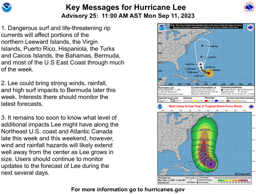
We have a hurricane spinning just north of the Caribbean that will soon take a hard turn to the north off the East Coast of the US which seems increasingly likely to cause impacts to New England and the Canadian Maritimes during Saturday and Sunday of next week. The exact location and extent of those impacts are far from certain given that we are 5 days away, though there is strong confidence in widespread high surf and rip currents off the East Coast. Some models have been shifting in the last 48 hours and are now favoring a jog west towards New England sometime around Friday evening which increases the concern in our focus area.
Our coverage of this storm will focus on official and professional sources and our own discussion of modeling trends. We recommend that you follow the National Hurricane Center (NHC), National Weather Service (NWS), and government authorities for guidance on the impacts as the storm approaches our region and recommendations for how to prepare.
We also recommend to those who are viewing our newsletters in email to follow the link to this article on our website where images can be viewed full screen and other elements such as videos, animated GIFs, and social media embeds work as desired. We also often make some edits or even add in new content after the initial publication of posts. Viewing from our site will always be recommended in order to access the most up to date information.
Latest NHC Update from 11 AM ET
The NHC forecasts out 5 days (120 hours) which brings the forecasted center of the storm approximately 350 miles due east of Atlantic City, NJ. More of the NHC's forecasting and guidance can be found on their Hurricane Lee page. They update every 6 hours starting at 5 a.m.
It is good to understand that the NHC's Track Forecast Cone is generated based on the average track error in the previous 5 seasons. In the Atlantic Basin the actual track of the storm will fall within 114 miles 3 days out and within 235 miles 5 days out two-thirds of the time. The cone itself is twice that width at a given time and does not change based on confidence in the forecast.
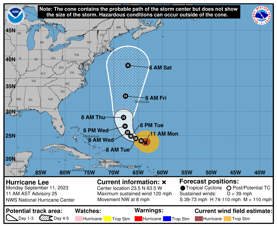
Currently the storm has a central pressure of 948 mb, is moving NW at 8 mph, and has sustained winds of 120 mph which makes it a Category 3 hurricane and also a major hurricane. In the last 24 hours the central pressure has dropped by 10 mb and sustained winds have increased by approximately 20 mph as the storm is experiencing less sheer. It is expected to slow dramatically over the next several days before starting to pick up some speed Thursday following a turn to the north. The NHC expects the storm to start to weaken at this time and become a Category 2 storm with winds no greater than 110 mph. They are not yet forecasting the strength as it nears New England and the Maritimes, though further weakening is of course likely in this scenario. That does not mean the impacts from the storm won't be cause for concern for those near the shore from high winds, storm surge, and surf, and further inland from wind and rain extending hundreds of miles from the center of circulation.


