We still don't have strong agreement within the major models on the exact track of Hurricane Lee as it approaches New England and the Maritimes, though at this range we're at a reasonable level of confidence within a certain range. We'll cover the latest NHC update, an explanatory video from Dr. Levi Cowan of Tropical Tidbits, and we'll take some of these elements apart similar to yesterday in a modeling discussion.
While our email newsletters provide subscribers with notifications and instant access to our published content, consider viewing this article directly on our site so that meaningful edits and updates are not missed and media is displayed more optimally.
Latest NHC Update from 11 AM ET
Today the NHC's Track Forecast Cone has reached the Maritimes by Sunday at 8 a.m. showing a weakening from minimal hurricane strength with 75 mph winds 24 hours earlier to 50 mph winds and tropical storm strength. The cone does reach Cape Cod and envelops practically all of Maine, New Brunswick, and Nova Scotia where the NHC's forecast track currently favors landfall. The Track Forecast Cone is designed to show enough variability that the storm will track within the boundaries 2/3 of a given time. More of the NHC's forecasting and guidance can be found on their Hurricane Lee page.
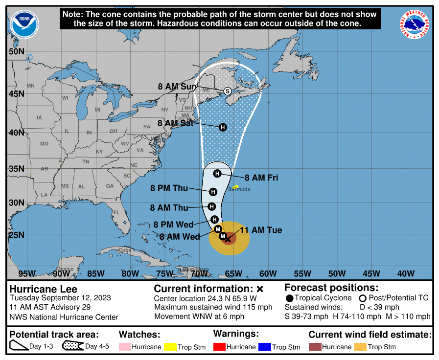
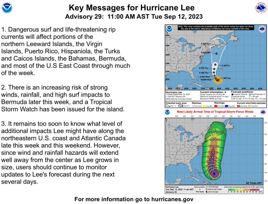
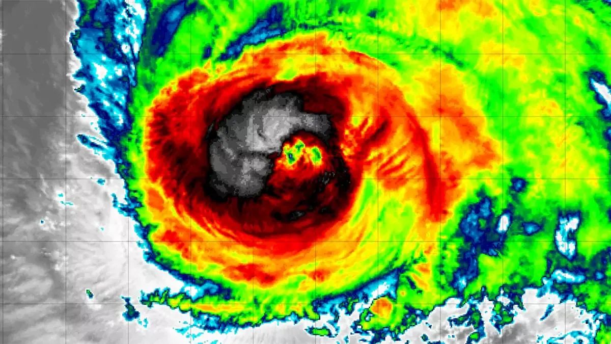
In the last 24 hours we have seen sustained winds drop by 5 mph down to 115 mph and this is approximately the strongest that the storm is expected to be from here on out. The NHC discussed a consolidation of inner eyewalls into one larger eyewall as the wind field spreads larger. The central pressure is now 951 mb, just 3 mb weaker than 24 hours earlier and the storm is moving WNW at 6 mph. There are no active tropical watches and warnings for New England or the Maritimes at this time, though they are likely to start appearing in the next two days.
Latest Update from Dr. Levi Cowan of Tropical Tidbits
Dr. Levi Cowan is the Senior Scientist at the Joint Typhoon Warning Center, but he has long offered these updates on notable tropical systems on his website Tropical Tidbits and his social media channels. He provides a sophisticated yet not overly technical presentation of the modeling for this storm in his updates and this is his first one on Lee since last Friday.


