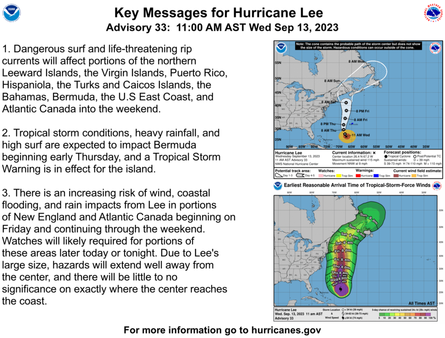
We're seeing some smaller adjustments to forecasting and modeling now that we are less than 72 hours out from the first notable impacts of Hurricane Lee in the Northeast. Generally we have seen the GFS as well as the NHC's forecast track shift west over the last 24 hours, and the ECMWF has in the latest run taken a similarly sized jog east to come remarkably in line with the GFS. While this isn't a major hurricane any longer and is expected to weaken to tropical storm intensity by landfall it will produce dangerous surf, coastal erosion, flooding, and damaging winds along the entire seacoast of the Gulf of Maine.
While our email newsletters provide subscribers with notifications and instant access to our published content, consider viewing this article directly on our site so that meaningful edits and updates are not missed and media is displayed more optimally.
Latest NHC Update from 2 PM ET
We're starting to get into the higher confidence 72 hour zone approaching the Gulf of Maine in the NHC's Track Forecast Cone by Saturday at 8 a.m. The NHC now expects maximum sustained winds of 80 mph Saturday morning as the storm starts to undergo extratropical transition at a latitude near even with NYC. By Sunday morning the storm is expected to be over New Brunswick with sustained winds of 60 mph before it races off to the Northeast. More of the NHC's forecasting and guidance can be found on their Hurricane Lee page.
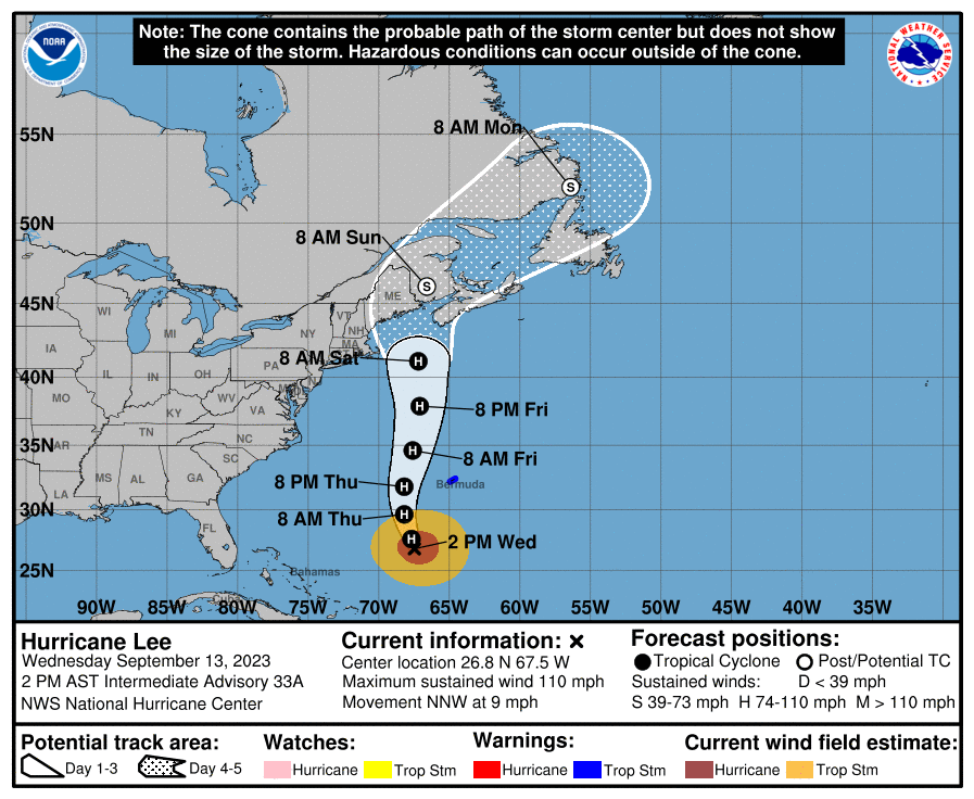
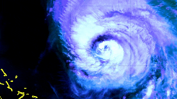
It is important to understand that the NHC only plots positions every 12 hours and the storm is expected to take a jog west during Saturday before turning somewhat sharply to the northeast late Saturday. Connecting the positions shown will not accurately chart the expected path. The latest update found maximum sustained winds of 110 mph, down 5 mph from yesterday, a central pressure of 948 mb which was a small strengthening of 3 mb from yesterday, and it is currently moving at about 9 mph towards the NNW. There have been no surprises of note.
Latest Update from Dr. Levi Cowan of Tropical Tidbits
Dr. Levi Cowan is the Senior Scientist at the Joint Typhoon Warning Center, but he has long offered these updates on notable tropical systems on his website Tropical Tidbits and his social media channels. He provides a sophisticated yet not overly technical presentation of the modeling for this storm in his updates.


